
Thank you for supporting this site ❤️
Make a donation
Make a donation
Velji Bostur topographic map
Click on the map to display elevation.
Thank you for supporting this site ❤️
Make a donation
Make a donation
About this map
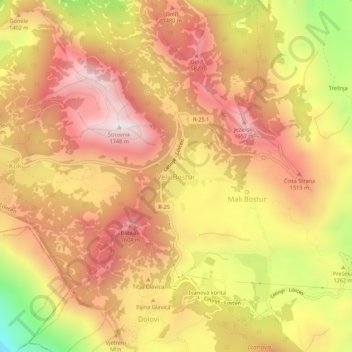
Name: Velji Bostur topographic map, elevation, terrain.
Location: Velji Bostur, Old Royal Capital Cetinje, Montenegro (42.37361 18.80722 42.41361 18.84722)
Average elevation: 1,340 m
Minimum elevation: 706 m
Maximum elevation: 1,737 m
Thank you for supporting this site ❤️
Make a donation
Make a donation
Other topographic maps
Click on a map to view its topography, its elevation and its terrain.