
Langfang City topographic map
Interactive map
Click on the map to display elevation.
About this map
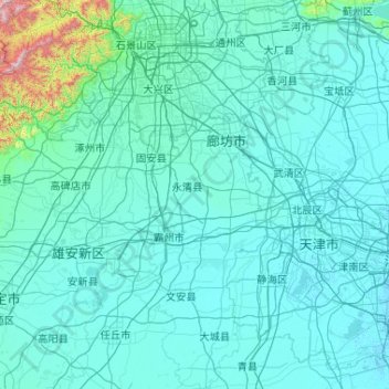
Name: Langfang City topographic map, elevation, terrain.
Location: Langfang City, Hebei, PRC (38.47284 116.11096 40.08367 117.25373)
Average elevation: 71 m
Minimum elevation: -2 m
Maximum elevation: 1,980 m
Other topographic maps
Click on a map to view its topography, its elevation and its terrain.