
Thank you for supporting this site ❤️
Make a donation
Make a donation
Kaldfjord topographic map
Click on the map to display elevation.
Thank you for supporting this site ❤️
Make a donation
Make a donation
About this map
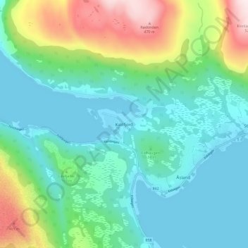
Name: Kaldfjord topographic map, elevation, terrain.
Location: Kaldfjord, Tromsø, Troms og Finnmark, 9105, Norge (69.66518 18.72076 69.70518 18.76076)
Average elevation: 127 m
Minimum elevation: -3 m
Maximum elevation: 508 m
Thank you for supporting this site ❤️
Make a donation
Make a donation
Other topographic maps
Click on a map to view its topography, its elevation and its terrain.