
Thank you for supporting this site ❤️
Make a donation
Make a donation
Pudupakkam topographic map
Click on the map to display elevation.
Thank you for supporting this site ❤️
Make a donation
Make a donation
About this map
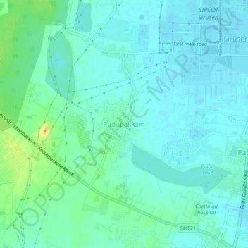
Name: Pudupakkam topographic map, elevation, terrain.
Location: Pudupakkam, Tiruporur, Chengalpattu, Tamil Nadu, 603103, India (12.78979 80.18354 12.82979 80.22354)
Average elevation: 9 m
Minimum elevation: 2 m
Maximum elevation: 32 m
Thank you for supporting this site ❤️
Make a donation
Make a donation
Other topographic maps
Click on a map to view its topography, its elevation and its terrain.