
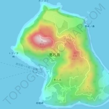
悪石島 topographic map
Interactive map
Click on the map to display elevation.
About this map
Name: 悪石島 topographic map, elevation, terrain.
Location: 悪石島, 十島村, 鹿児島郡, Préfecture de Kagoshima, Kyūshū, Japon (29.44470 129.58398 29.47715 129.62019)
Average elevation: 112 m
Minimum elevation: -1 m
Maximum elevation: 556 m