
Thank you for supporting this site ❤️
Make a donation
Make a donation
Northwest topographic map
Click on the map to display elevation.
Thank you for supporting this site ❤️
Make a donation
Make a donation
About this map
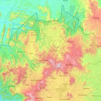
Name: Northwest topographic map, elevation, terrain.
Location: Northwest, Cameroon (5.70440 9.59045 7.16224 11.21044)
Average elevation: 950 m
Minimum elevation: 136 m
Maximum elevation: 2,971 m
Thank you for supporting this site ❤️
Make a donation
Make a donation
Other topographic maps
Click on a map to view its topography, its elevation and its terrain.