
Departamento de Canindeyú topographic map
Interactive map
Click on the map to display elevation.
About this map
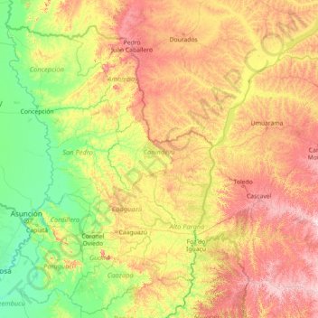
Name: Departamento de Canindeyú topographic map, elevation, terrain.
Average elevation: 293 m
Minimum elevation: 49 m
Maximum elevation: 1,090 m
Other topographic maps
Click on a map to view its topography, its elevation and its terrain.
Ciudad de Corpus Christi
Paraguay > Canindeyú > Ciudad de Corpus Christi
Ciudad de Corpus Christi, Corpus Christi, Canindeyú, Región Oriental, Paraguay
Average elevation: 412 m