
Sarratt topographic map
Click on the map to display elevation.
About this map
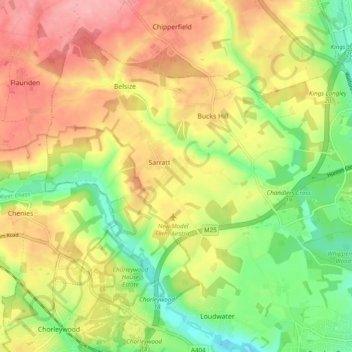
Name: Sarratt topographic map, elevation, terrain.
Location: Sarratt, Three Rivers, Hertfordshire, England, United Kingdom (51.65597 -0.52501 51.70657 -0.42754)
Average elevation: 107 m
Minimum elevation: 53 m
Maximum elevation: 159 m
Other topographic maps
Click on a map to view its topography, its elevation and its terrain.
Sarratt Bottom
United Kingdom > England > Hertfordshire > Three Rivers > Sarratt
Average elevation: 112 m