
Monona County topographic map
Interactive map
Click on the map to display elevation.
About this map
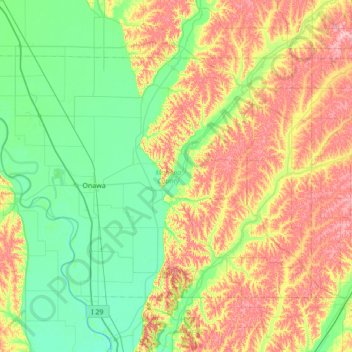
Name: Monona County topographic map, elevation, terrain.
Location: Monona County, Iowa, United States of America (41.86188 -96.35987 42.21486 -95.67046)
Average elevation: 359 m
Minimum elevation: 304 m
Maximum elevation: 460 m
Other topographic maps
Click on a map to view its topography, its elevation and its terrain.
Iowa County
United States of America > Iowa
Iowa County, Iowa, United States of America
Average elevation: 249 m
Woodbury County
United States of America > Iowa
Woodbury County, Iowa, United States of America
Average elevation: 376 m
Linn County
United States of America > Iowa
Linn County, Iowa, United States of America
Average elevation: 261 m