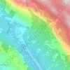
Vrbovsko topographic map
Click on the map to display elevation.
Vrbovsko
In the north, river Kupa separates Vrbovsko from adjoining Slovenia, while the eastern border follows the line of Zdihovo, Liplje and Bosiljevo settlements and cuts through the river Dobra valley near Ljubošina. The western border starts at the Kupa gorge at Radočaj, goes around Razdrto and passes over the railway tracks between Koritnik Veliki and Palež, continues to Lužac and ends in Sušica-Jablan area. The southern border is the highest in its relief characteristics – it runs along mountain peaks at an altitude of 1000 meters or higher. Debela Kosa (1169 m), Bukovica (1253 m), Bijela kosa (1289 m), Mirkovica (1283 m), and Smolnik (1219 m) peaks are especially distinguishable by their beauty, forests and height. Towards the east, the border continues over Kozarice and Lombarda passes, and ends in the river Dobra valley, thus rounding off Vrbovsko area.
About this map

Name: Vrbovsko topographic map, elevation, terrain.
Location: Vrbovsko, Grad Vrbovsko, Primorje-Gorski Kotar County, Croatia (45.35827 15.03230 45.39969 15.10266)
Average elevation: 519 m
Minimum elevation: 352 m
Maximum elevation: 890 m
Other topographic maps
Click on a map to view its topography, its elevation and its terrain.