
Thank you for supporting this site ❤️
Make a donation
Make a donation
Funtington topographic map
Click on the map to display elevation.
Thank you for supporting this site ❤️
Make a donation
Make a donation
About this map
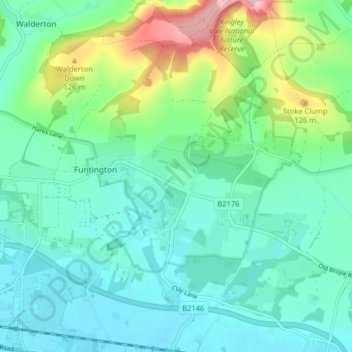
Name: Funtington topographic map, elevation, terrain.
Location: Funtington, Chichester, West Sussex, England, United Kingdom (50.84283 -0.88409 50.89345 -0.80639)
Average elevation: 50 m
Minimum elevation: 4 m
Maximum elevation: 199 m
Thank you for supporting this site ❤️
Make a donation
Make a donation