
Thank you for supporting this site ❤️
Make a donation
Make a donation
Weissach im Tal topographic map
Click on the map to display elevation.
Thank you for supporting this site ❤️
Make a donation
Make a donation
About this map
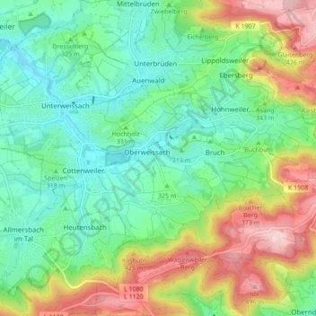
Name: Weissach im Tal topographic map, elevation, terrain.
Average elevation: 330 m
Minimum elevation: 250 m
Maximum elevation: 504 m
Thank you for supporting this site ❤️
Make a donation
Make a donation
Other topographic maps
Click on a map to view its topography, its elevation and its terrain.
Kleinhegnach
Germany > Baden-Württemberg > Rems-Murr-Kreis > Waiblingen > Neustadt
Average elevation: 277 m