
Thank you for supporting this site ❤️
Make a donation
Make a donation
Saint-Michel-Chef-Chef topographic map
Click on the map to display elevation.
Thank you for supporting this site ❤️
Make a donation
Make a donation
About this map
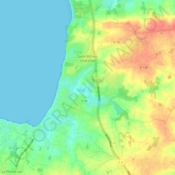
Name: Saint-Michel-Chef-Chef topographic map, elevation, terrain.
Average elevation: 20 m
Minimum elevation: 0 m
Maximum elevation: 54 m
Thank you for supporting this site ❤️
Make a donation
Make a donation
Other topographic maps
Click on a map to view its topography, its elevation and its terrain.
La Bessonnière
France > Pays de la Loire > Loire-Atlantique > La Chapelle-sur-Erdre
Average elevation: 30 m
Thank you for supporting this site ❤️
Make a donation
Make a donation
Thank you for supporting this site ❤️
Make a donation
Make a donation
La Jaunais
France > Pays de la Loire > Loire-Atlantique > Guémené-Penfao > La Jaunais
Average elevation: 22 m