
Thank you for supporting this site ❤️
Make a donation
Make a donation
Kampung Seraya topographic map
Click on the map to display elevation.
Thank you for supporting this site ❤️
Make a donation
Make a donation
About this map
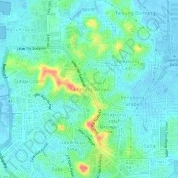
Name: Kampung Seraya topographic map, elevation, terrain.
Location: Kampung Seraya, Batam, Riau Islands, Sumatra, 29454, Indonesia (1.13362 104.00094 1.17362 104.04094)
Average elevation: 17 m
Minimum elevation: -4 m
Maximum elevation: 81 m
Thank you for supporting this site ❤️
Make a donation
Make a donation
Other topographic maps
Click on a map to view its topography, its elevation and its terrain.