
Thank you for supporting this site ❤️
Make a donation
Make a donation
El Brañillín topographic map
Click on the map to display elevation.
Thank you for supporting this site ❤️
Make a donation
Make a donation
About this map
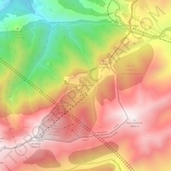
Name: El Brañillín topographic map, elevation, terrain.
Location: El Brañillín, Lena, Asturias, España (42.96006 -5.79404 43.00006 -5.75404)
Average elevation: 1,431 m
Minimum elevation: 816 m
Maximum elevation: 1,858 m
Thank you for supporting this site ❤️
Make a donation
Make a donation
Other topographic maps
Click on a map to view its topography, its elevation and its terrain.