
Olembé topographic map
Interactive map
Click on the map to display elevation.
About this map
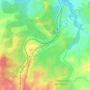
Name: Olembé topographic map, elevation, terrain.
Location: Olembé, Batchenga, Lekié, Région du Centre, Cameroun (4.28751 11.64280 4.32751 11.68280)
Average elevation: 489 m
Minimum elevation: 452 m
Maximum elevation: 537 m
Other topographic maps
Click on a map to view its topography, its elevation and its terrain.
Niévé
Cameroun > Région du Centre > Lekié > Batchenga
Niévé, Batchenga, Lekié, Région du Centre, Cameroun
Average elevation: 516 m