
Thank you for supporting this site ❤️
Make a donation
Make a donation
Belmont topographic map
Click on the map to display elevation.
Thank you for supporting this site ❤️
Make a donation
Make a donation
About this map
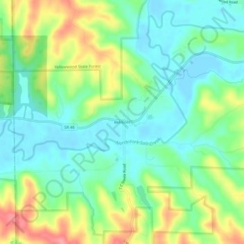
Name: Belmont topographic map, elevation, terrain.
Location: Belmont, Brown County, Indiana, United States (39.13199 -86.36721 39.17199 -86.32721)
Average elevation: 196 m
Minimum elevation: 165 m
Maximum elevation: 254 m
Thank you for supporting this site ❤️
Make a donation
Make a donation
Other topographic maps
Click on a map to view its topography, its elevation and its terrain.