
Thank you for supporting this site ❤️
Make a donation
Make a donation
Cloquet topographic map
Click on the map to display elevation.
Thank you for supporting this site ❤️
Make a donation
Make a donation
About this map
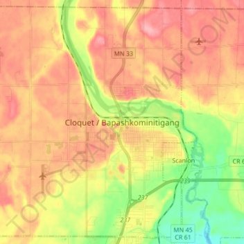
Name: Cloquet topographic map, elevation, terrain.
Location: Cloquet, Carlton County, Minnesota, 55720, United States (46.67759 -92.55539 46.76608 -92.42002)
Average elevation: 376 m
Minimum elevation: 320 m
Maximum elevation: 418 m
Thank you for supporting this site ❤️
Make a donation
Make a donation
Other topographic maps
Click on a map to view its topography, its elevation and its terrain.