
Thank you for supporting this site ❤️
Make a donation
Make a donation
Rio Grande topographic map
Click on the map to display elevation.
Thank you for supporting this site ❤️
Make a donation
Make a donation
About this map
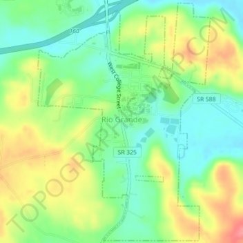
Name: Rio Grande topographic map, elevation, terrain.
Location: Rio Grande, Gallia County, Ohio, United States (38.86603 -82.39243 38.89245 -82.36781)
Average elevation: 209 m
Minimum elevation: 176 m
Maximum elevation: 255 m
Thank you for supporting this site ❤️
Make a donation
Make a donation
Other topographic maps
Click on a map to view its topography, its elevation and its terrain.