
Thank you for supporting this site ❤️
Make a donation
Make a donation
Chickamauga Lake topographic map
Click on the map to display elevation.
Thank you for supporting this site ❤️
Make a donation
Make a donation
About this map
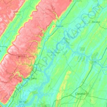
Name: Chickamauga Lake topographic map, elevation, terrain.
Average elevation: 335 m
Minimum elevation: 193 m
Maximum elevation: 720 m
Thank you for supporting this site ❤️
Make a donation
Make a donation
Other topographic maps
Click on a map to view its topography, its elevation and its terrain.
Pine Harbor Heights
United States > Tennessee > Hamilton County > Soddy-Daisy
Average elevation: 238 m