
Thank you for supporting this site ❤️
Make a donation
Make a donation
Centralia topographic map
Click on the map to display elevation.
Thank you for supporting this site ❤️
Make a donation
Make a donation
About this map
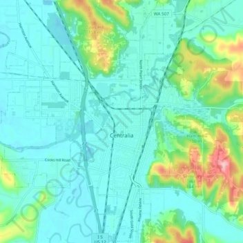
Name: Centralia topographic map, elevation, terrain.
Location: Centralia, Lewis County, Washington, United States (46.69155 -123.01989 46.75665 -122.92395)
Average elevation: 74 m
Minimum elevation: 43 m
Maximum elevation: 195 m
Thank you for supporting this site ❤️
Make a donation
Make a donation
Other topographic maps
Click on a map to view its topography, its elevation and its terrain.