
Pic Chaussy topographic map
Interactive map
Click on the map to display elevation.
About this map
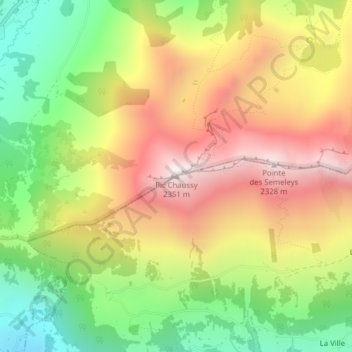
Name: Pic Chaussy topographic map, elevation, terrain.
Location: Pic Chaussy, Ormont-Dessus, District d'Aigle, Vaud, 1864, Suisse (46.37700 7.11270 46.37710 7.11280)
Average elevation: 1,793 m
Minimum elevation: 1,273 m
Maximum elevation: 2,332 m
Other topographic maps
Click on a map to view its topography, its elevation and its terrain.
Grande Eau
Suisse > Vaud > Ormont-Dessus
Grande Eau, Ormont-Dessus, District d'Aigle, Vaud, 1865, Suisse
Average elevation: 1,329 m