
Thank you for supporting this site ❤️
Make a donation
Make a donation
Rajhena topographic map
Click on the map to display elevation.
Thank you for supporting this site ❤️
Make a donation
Make a donation
About this map
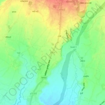
Name: Rajhena topographic map, elevation, terrain.
Location: Rajhena, Tulsipur, Dang, 22412, Nepal (28.06995 82.26623 28.10995 82.30623)
Average elevation: 603 m
Minimum elevation: 580 m
Maximum elevation: 633 m
Thank you for supporting this site ❤️
Make a donation
Make a donation