
Thank you for supporting this site ❤️
Make a donation
Make a donation
Preggio topographic map
Click on the map to display elevation.
Thank you for supporting this site ❤️
Make a donation
Make a donation
About this map
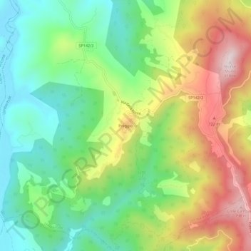
Name: Preggio topographic map, elevation, terrain.
Location: Preggio, Umbertide, Perugia, Umbria, 06019, Italia (43.22213 12.20306 43.26213 12.24306)
Average elevation: 497 m
Minimum elevation: 287 m
Maximum elevation: 816 m
Thank you for supporting this site ❤️
Make a donation
Make a donation