
Robertsonville topographic map
Interactive map
Click on the map to display elevation.
About this map
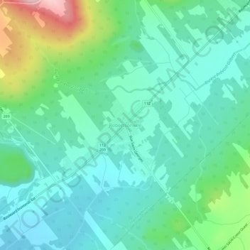
Name: Robertsonville topographic map, elevation, terrain.
Average elevation: 391 m
Minimum elevation: 331 m
Maximum elevation: 579 m
Other topographic maps
Click on a map to view its topography, its elevation and its terrain.
Lac-à-la-Truite
Canada > Québec > Les Appalaches > Thetford Mines
Lac-à-la-Truite, Thetford Mines, Les Appalaches, Chaudière-Appalaches, Québec, Canada
Average elevation: 426 m
Lac-Bécancour
Canada > Québec > Les Appalaches > Thetford Mines > Lac-Bécancour
Lac-Bécancour, Thetford Mines, Les Appalaches, Chaudière-Appalaches, Québec, Canada
Average elevation: 420 m