
Thank you for supporting this site ❤️
Make a donation
Make a donation
Ställberg topographic map
Click on the map to display elevation.
Thank you for supporting this site ❤️
Make a donation
Make a donation
About this map
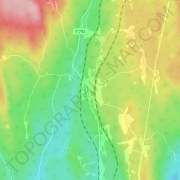
Name: Ställberg topographic map, elevation, terrain.
Location: Ställberg, Ljusnarsbergs kommun, Örebro County, 714 72, Sweden (59.95749 14.90718 59.99749 14.94718)
Average elevation: 249 m
Minimum elevation: 175 m
Maximum elevation: 357 m
Thank you for supporting this site ❤️
Make a donation
Make a donation
Other topographic maps
Click on a map to view its topography, its elevation and its terrain.