
Thank you for supporting this site ❤️
Make a donation
Make a donation
Enggin topographic map
Click on the map to display elevation.
Thank you for supporting this site ❤️
Make a donation
Make a donation
About this map
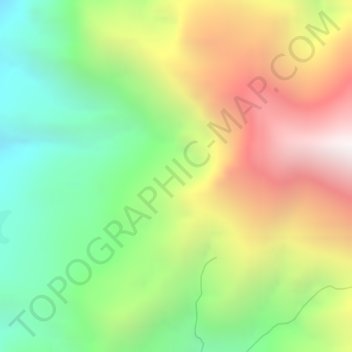
Name: Enggin topographic map, elevation, terrain.
Location: Enggin, Mimika, Central Papua, Western New Guinea, Indonesia (-4.23018 137.68907 -4.21018 137.70907)
Average elevation: 1,708 m
Minimum elevation: 1,076 m
Maximum elevation: 2,440 m
Thank you for supporting this site ❤️
Make a donation
Make a donation
Other topographic maps
Click on a map to view its topography, its elevation and its terrain.