
Pettingen topographic map
Interactive map
Click on the map to display elevation.
About this map
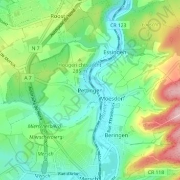
Name: Pettingen topographic map, elevation, terrain.
Location: Pettingen, Mersch, Canton Mersch, 7463, Luxembourg (49.75039 6.08719 49.79039 6.12719)
Average elevation: 268 m
Minimum elevation: 210 m
Maximum elevation: 391 m