
Thank you for supporting this site ❤️
Make a donation
Make a donation
Nawangan topographic map
Click on the map to display elevation.
Thank you for supporting this site ❤️
Make a donation
Make a donation
About this map
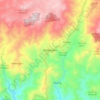
Name: Nawangan topographic map, elevation, terrain.
Location: Nawangan, Pacitan, East Java, Java, Indonesia (-8.03775 111.14842 -7.95775 111.22842)
Average elevation: 727 m
Minimum elevation: 266 m
Maximum elevation: 1,205 m
Thank you for supporting this site ❤️
Make a donation
Make a donation