
Thank you for supporting this site ❤️
Make a donation
Make a donation
Vedelago topographic map
Click on the map to display elevation.
Thank you for supporting this site ❤️
Make a donation
Make a donation
About this map
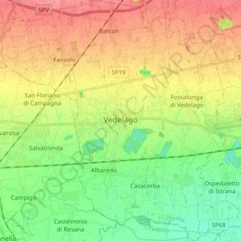
Name: Vedelago topographic map, elevation, terrain.
Location: Vedelago, Treviso, Veneto, Italy (45.63844 11.94977 45.73388 12.07763)
Average elevation: 46 m
Minimum elevation: 15 m
Maximum elevation: 80 m
Thank you for supporting this site ❤️
Make a donation
Make a donation
Other topographic maps
Click on a map to view its topography, its elevation and its terrain.
Thank you for supporting this site ❤️
Make a donation
Make a donation