
Shamator District topographic map
Interactive map
Click on the map to display elevation.
About this map
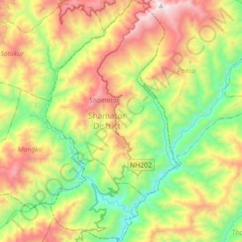
Name: Shamator District topographic map, elevation, terrain.
Location: Shamator District, Nagaland, Indien (25.98062 94.79849 26.19954 94.93389)
Average elevation: 1,369 m
Minimum elevation: 572 m
Maximum elevation: 2,659 m