
Monongalia County topographic map
Interactive map
Click on the map to display elevation.
About this map
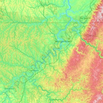
Name: Monongalia County topographic map, elevation, terrain.
Location: Monongalia County, Virginia Occidental, Estados Unidos (39.43575 -80.42173 39.72116 -79.76186)
Average elevation: 418 m
Minimum elevation: 234 m
Maximum elevation: 840 m
Other topographic maps
Click on a map to view its topography, its elevation and its terrain.
Virginia Occidental
Estados Unidos > Virginia Occidental
Virginia Occidental, Estados Unidos
Average elevation: 430 m