
Thank you for supporting this site ❤️
Make a donation
Make a donation
La Paix topographic map
Click on the map to display elevation.
Thank you for supporting this site ❤️
Make a donation
Make a donation
About this map
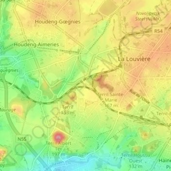
Name: La Paix topographic map, elevation, terrain.
Location: La Paix, La Louvière, Hainaut, Wallonie, 7100, Belgique (50.45305 4.14768 50.49305 4.18768)
Average elevation: 107 m
Minimum elevation: 53 m
Maximum elevation: 168 m
Thank you for supporting this site ❤️
Make a donation
Make a donation
Other topographic maps
Click on a map to view its topography, its elevation and its terrain.