
ʻĪao Valley State Monument topographic map
Interactive map
Click on the map to display elevation.
About this map
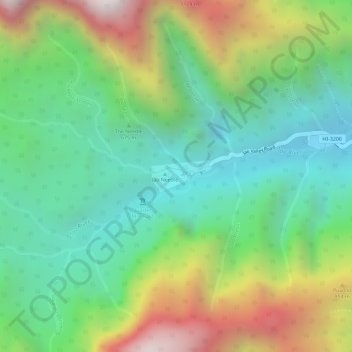
Name: ʻĪao Valley State Monument topographic map, elevation, terrain.
Average elevation: 629 m
Minimum elevation: 216 m
Maximum elevation: 1,310 m
Other topographic maps
Click on a map to view its topography, its elevation and its terrain.
Lānaʻi
United States > Hawaii > Maui County
Lānaʻi, Maui County, Hawaii, 96763, United States
Average elevation: 162 m