
Thank you for supporting this site ❤️
Make a donation
Make a donation
Phagwara Tahsil topographic map
Click on the map to display elevation.
Thank you for supporting this site ❤️
Make a donation
Make a donation
About this map
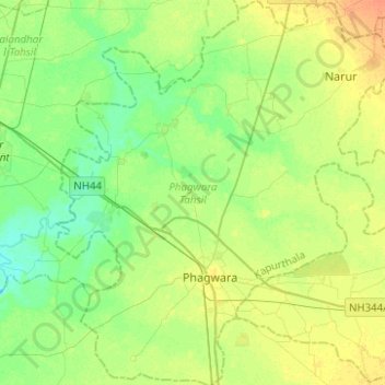
Name: Phagwara Tahsil topographic map, elevation, terrain.
Location: Phagwara Tahsil, Kapurthala, Punjab, India (31.16074 75.66971 31.37299 75.90967)
Average elevation: 241 m
Minimum elevation: 229 m
Maximum elevation: 257 m
Thank you for supporting this site ❤️
Make a donation
Make a donation
Other topographic maps
Click on a map to view its topography, its elevation and its terrain.