
Nottinghamshire topographic map
Interactive map
Click on the map to display elevation.
About this map
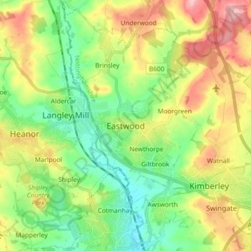
Name: Nottinghamshire topographic map, elevation, terrain.
Average elevation: 99 m
Minimum elevation: 45 m
Maximum elevation: 181 m
Other topographic maps
Click on a map to view its topography, its elevation and its terrain.
Edwinstowe
United Kingdom > England > Nottinghamshire > Edwinstowe
Edwinstowe, Nottinghamshire, East Midlands, England, NG21 9QW, United Kingdom
Average elevation: 67 m