
Kok Lanas topographic map
Interactive map
Click on the map to display elevation.
About this map
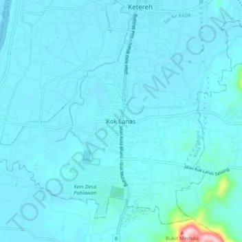
Name: Kok Lanas topographic map, elevation, terrain.
Location: Kok Lanas, Kota Bharu, Kelantan, Malaysia (5.88099 102.20483 5.96099 102.28483)
Average elevation: 30 m
Minimum elevation: 5 m
Maximum elevation: 394 m