
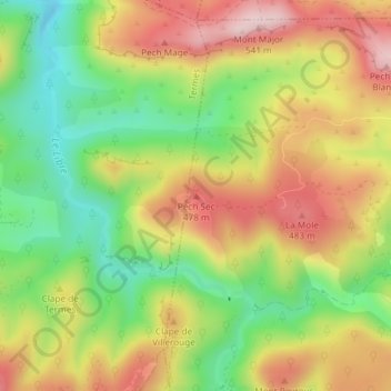
Pech Sec topographic map
Interactive map
Click on the map to display elevation.
About this map
Name: Pech Sec topographic map, elevation, terrain.
Average elevation: 364 m
Minimum elevation: 210 m
Maximum elevation: 525 m
Other topographic maps
Click on a map to view its topography, its elevation and its terrain.
La Mole
France > Occitanie > Aude > Villerouge-Termenès
La Mole, Villerouge-Termenès, Narbonne, Aude, Occitanie, France métropolitaine, 11330, France
Average elevation: 382 m