
Lieja topographic map
Interactive map
Click on the map to display elevation.
About this map
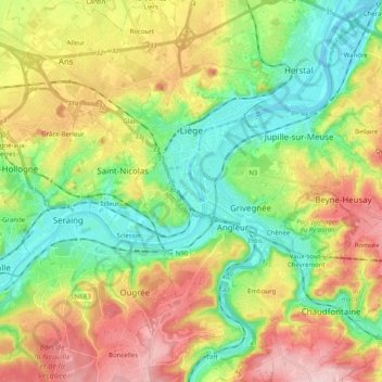
Name: Lieja topographic map, elevation, terrain.
Location: Lieja, Valonia, 4000, Bélgica (50.56102 5.52339 50.68820 5.67526)
Average elevation: 147 m
Minimum elevation: 53 m
Maximum elevation: 286 m