Geolocate
👉 Easily get elevation data in JSON, GeoTIFF and KML formats using Elevation API
Thank you for supporting this site ❤️
Make a donation

Barauni topographic map

Click on the map to display elevation.

👉 Easily get elevation data in JSON, GeoTIFF and KML formats using Elevation API
Thank you for supporting this site ❤️
Make a donation

About this map

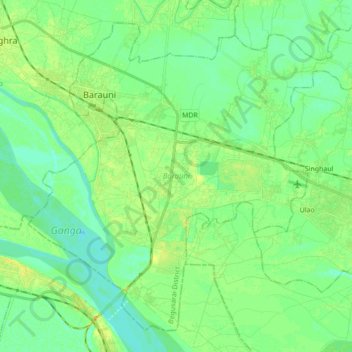
Name: Barauni topographic map, elevation, terrain.

Location: Barauni, Begusarai, Bihar, India (25.36293 85.95667 25.50034 86.12912)

Average elevation: 42 m

Minimum elevation: 33 m

Maximum elevation: 58 m