
Girkhausen topographic map
Interactive map
Click on the map to display elevation.
About this map
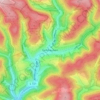
Name: Girkhausen topographic map, elevation, terrain.
Average elevation: 599 m
Minimum elevation: 462 m
Maximum elevation: 738 m
Other topographic maps
Click on a map to view its topography, its elevation and its terrain.
Poppel
Duitsland > Noordrijn-Westfalen > Kreis Siegen-Wittgenstein > Bad Berleburg
Poppel, Bad Berleburg, Kreis Siegen-Wittgenstein, Noordrijn-Westfalen, 57319, Duitsland
Average elevation: 569 m