
Thank you for supporting this site ❤️
Make a donation
Make a donation
Erpent topographic map
Click on the map to display elevation.
Thank you for supporting this site ❤️
Make a donation
Make a donation
About this map
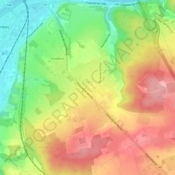
Name: Erpent topographic map, elevation, terrain.
Location: Erpent, Namur, Wallonie, 5101, Belgique (50.42769 4.87974 50.46454 4.92568)
Average elevation: 149 m
Minimum elevation: 74 m
Maximum elevation: 218 m
Thank you for supporting this site ❤️
Make a donation
Make a donation
Other topographic maps
Click on a map to view its topography, its elevation and its terrain.