
Thank you for supporting this site ❤️
Make a donation
Make a donation
San Lorenzo topographic map
Click on the map to display elevation.
Thank you for supporting this site ❤️
Make a donation
Make a donation
About this map
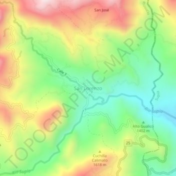
Name: San Lorenzo topographic map, elevation, terrain.
Location: San Lorenzo, Riosucio, Alto Occidente, Caldas, Colombia (5.44419 -75.71370 5.48419 -75.67370)
Average elevation: 1,539 m
Minimum elevation: 1,224 m
Maximum elevation: 1,963 m
Thank you for supporting this site ❤️
Make a donation
Make a donation
Other topographic maps
Click on a map to view its topography, its elevation and its terrain.