
Thank you for supporting this site ❤️
Make a donation
Make a donation
Camerig topographic map
Click on the map to display elevation.
Thank you for supporting this site ❤️
Make a donation
Make a donation
About this map
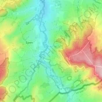
Name: Camerig topographic map, elevation, terrain.
Location: Camerig, Villen, Vaals, Limburg, Niederlande, 6294, Niederlande (50.75327 5.90592 50.79327 5.94592)
Average elevation: 166 m
Minimum elevation: 102 m
Maximum elevation: 274 m
Thank you for supporting this site ❤️
Make a donation
Make a donation