
Pleisenspitze topographic map
Interactive map
Click on the map to display elevation.
About this map
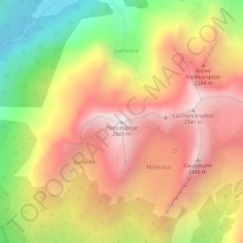
Name: Pleisenspitze topographic map, elevation, terrain.
Location: Pleisenspitze, Scharnitz, Innsbruck-Land, Tirol, Österreich (47.40863 11.34190 47.40873 11.34200)
Average elevation: 1,928 m
Minimum elevation: 1,149 m
Maximum elevation: 2,553 m