
Granges-Paccot topographic map
Interactive map
Click on the map to display elevation.
About this map
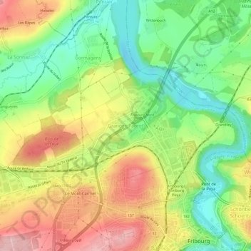
Name: Granges-Paccot topographic map, elevation, terrain.
Location: Granges-Paccot, District de la Sarine, Fribourg, 1763, Suisse (46.80397 7.12419 46.84397 7.16419)
Average elevation: 605 m
Minimum elevation: 524 m
Maximum elevation: 700 m