
Finishütte topographic map
Interactive map
Click on the map to display elevation.
About this map
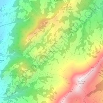
Name: Finishütte topographic map, elevation, terrain.
Location: Finishütte, Schüpfheim, Lucerne, 6170, Suisse (46.90323 8.02630 46.94323 8.06630)
Average elevation: 1,279 m
Minimum elevation: 757 m
Maximum elevation: 1,955 m