
Alle topographic map
Interactive map
Click on the map to display elevation.
About this map
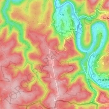
Name: Alle topographic map, elevation, terrain.
Location: Alle, Vresse-sur-Semois, Dinant, Namen, Wallonië, België (49.79782 4.94245 49.84891 4.99057)
Average elevation: 308 m
Minimum elevation: 184 m
Maximum elevation: 398 m
Other topographic maps
Click on a map to view its topography, its elevation and its terrain.
Vresse-sur-Semois
België > Namen > Dinant > Vresse-sur-Semois
Vresse-sur-Semois, Dinant, Namen, Wallonië, 5550, België
Average elevation: 284 m