
Thank you for supporting this site ❤️
Make a donation
Make a donation
Nungba topographic map
Click on the map to display elevation.
Thank you for supporting this site ❤️
Make a donation
Make a donation
About this map
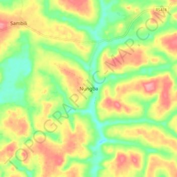
Name: Nungba topographic map, elevation, terrain.
Location: Nungba, Lower Uele, Democratic Republic of the Congo (4.39098 23.70913 4.47098 23.78913)
Average elevation: 547 m
Minimum elevation: 498 m
Maximum elevation: 600 m
Thank you for supporting this site ❤️
Make a donation
Make a donation
Other topographic maps
Click on a map to view its topography, its elevation and its terrain.