
Thank you for supporting this site ❤️
Make a donation
Make a donation
Mount Horrible topographic map
Click on the map to display elevation.
Thank you for supporting this site ❤️
Make a donation
Make a donation
About this map
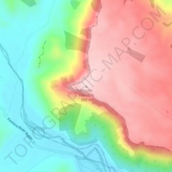
Name: Mount Horrible topographic map, elevation, terrain.
Location: Mount Horrible, Timaru District, Canterbury, New Zealand (-44.40047 171.05723 -44.40037 171.05733)
Average elevation: 226 m
Minimum elevation: 81 m
Maximum elevation: 387 m
Thank you for supporting this site ❤️
Make a donation
Make a donation
Other topographic maps
Click on a map to view its topography, its elevation and its terrain.